


Voting District 40125, Imperial County, California
About
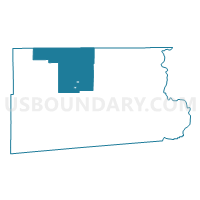
Outline

Summary
| Unique Area Identifier | 531069 |
| Name | Voting District 40125 |
| County | Imperial County |
| State | California |
| Area (square miles) | 507.62 |
| Land Area (square miles) | 416.32 |
| Water Area (square miles) | 91.29 |
| % of Land Area | 82.02 |
| % of Water Area | 17.98 |
| Latitude of the Internal Point | 33.28193020 |
| Longtitude of the Internal Point | -115.56056430 |
Maps


Graphs
Select a template below for downloading or customizing gragh for Voting District 40125, Imperial County, California


Neighbors
Neighoring Voting District (by Name) Neighboring Voting District on the Map
- Voting District 40115, Imperial County, CA
- Voting District 40116, Imperial County, CA
- Voting District 40117, Imperial County, CA
- Voting District 40130, Imperial County, CA
- Voting District 40145, Imperial County, CA
- Voting District 40150, Imperial County, CA
- Voting District 40155, Imperial County, CA
- Voting District 40160, Imperial County, CA
- Voting District 44515, Riverside County, CA
- Voting District 44535, Riverside County, CA
- Voting District 44575, Riverside County, CA
- Voting District 44585, Riverside County, CA
- Voting District 44600, Riverside County, CA
Top 10 Neighboring County Subdivision (by Population) Neighboring County Subdivision on the Map
- Coachella Valley CCD, Riverside County, CA (180,693)
- Calipatria-Westmorland CCD, Imperial County, CA (12,248)
- West Imperial CCD, Imperial County, CA (10,389)
- Chuckwalla Valley CCD, Riverside County, CA (9,843)
- East Imperial CCD, Imperial County, CA (1,266)
Top 10 Neighboring Place (by Population) Neighboring Place on the Map
Top 10 Neighboring Elementary School District (by Population) Neighboring Elementary School District on the Map
- Brawley Elementary School District, CA (25,664)
- Westmorland Union Elementary School District, CA (2,606)
- Magnolia Union Elementary School District, CA (181)
- Mulberry Elementary School District, CA (146)
Top 10 Neighboring Secondary School District (by Population) Neighboring Secondary School District on the Map
Top 10 Neighboring Unified School District (by Population) Neighboring Unified School District on the Map
- Coachella Valley Unified School District, CA (85,553)
- Calipatria Unified School District, CA (10,397)
- Desert Center Unified School District, CA (242)
Top 10 Neighboring State Legislative District Lower Chamber (by Population) Neighboring State Legislative District Lower Chamber on the Map
Top 10 Neighboring State Legislative District Upper Chamber (by Population) Neighboring State Legislative District Upper Chamber on the Map
Top 10 Neighboring 111th Congressional District (by Population) Neighboring 111th Congressional District on the Map
Top 10 Neighboring Census Tract (by Population) Neighboring Census Tract on the Map
- Census Tract 456.04, Riverside County, CA (13,694)
- Census Tract 101.02, Imperial County, CA (5,007)
- Census Tract 123.02, Imperial County, CA (4,756)
- Census Tract 101.01, Imperial County, CA (4,601)
- Census Tract 102, Imperial County, CA (2,640)
- Census Tract 469, Riverside County, CA (2,043)
- Census Tract 124, Imperial County, CA (1,266)